At the very edge of Delhi, where GT Karnal Road stretches toward the Haryana border, an entire industrial sub-city has grown around numbered plots and lettered blocks. DSIIDC Narela Industrial Area is one of Delhi’s largest planned manufacturing estates — built to house thousands of small and medium enterprises relocated from the congested inner city — and today it functions as a genuine economic anchor for North West Delhi. Here’s a full look at what operates here, where it sits, how to get around, and what facilities surround the belt.
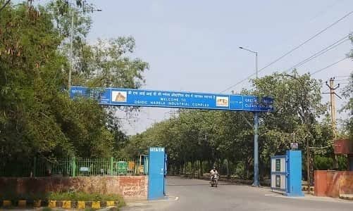
DSIIDC Narela Industrial Area Overview
| Category | Details |
| Location | Narela sub-city, North West Delhi, off NH-44 (GT Karnal Road) |
| PIN Code | 110040 |
| District | North West Delhi |
| Developed By | Delhi State Industrial and Infrastructure Development Corporation (DSIIDC) |
| Layout | Divided into lettered blocks (A through J and beyond), each with numbered plots |
| Major Industries | Manufacturing, packaging, plastic goods, pharmaceuticals, engineering, warehousing |
| Nearest Railway Station | Narela Railway Station, approx. 1.3 km, on the Delhi–Ambala rail route |
| Current Nearest Metro | Jahangirpuri or Samaypur Badli (Yellow Line), roughly 10–20 km away |
| Upcoming Metro | Narela Metro Station on the Rithala-Narela-Kundli corridor (Red Line, Phase IV), targeted for completion around 2029 |
| Major Road Access | NH-44 (GT Karnal Road), Alipur-Narela Road, Narela-Bawana Flyover, Sonipat-Narela Road |
| Nearby Localities | Bawana, Alipur, Narela Town, Bhorgarh, Holambi Kalan |
| Nearest Airport | Indira Gandhi International Airport, approx. 40 km |
Where DSIIDC Narela Industrial Area Sits
Narela sits at Delhi’s northernmost edge, close enough to the Haryana border that GT Karnal Road effectively continues on toward Sonipat and Kundli just past it. The industrial area falls under the 110040 PIN code, shared with the wider Narela sub-city, which was originally developed by the DDA as a planned residential and industrial township. Within the estate itself, addresses follow a lettered-block-plus-plot-number system — for instance, “H-1429, DSIIDC Industrial Area, Narela” — meaning the block letter and plot number together are essential for locating any specific unit, since the estate spans a genuinely large area with dozens of internal blocks.
Why This Estate Exists: A Relocation-Driven Industrial Zone
Like several other DSIIDC estates in Delhi, Narela’s industrial area was built with a specific purpose in mind:
- It was developed to accommodate small-scale units being moved out of residential and non-conforming zones across Delhi as part of the city’s broader industrial relocation policy
- The estate offers plotted industrial land with basic civic infrastructure — roads, drainage, and power connections — that many relocated units previously lacked
- Alongside the industrial plots, Narela has grown into a genuine mixed-use sub-city, with DDA-developed residential sectors, government colonies, and markets built up around the industrial core
- Affordable plot and rental pricing compared to more central Delhi industrial zones has kept attracting new small and medium businesses here over the years
The Kind of Companies Operating in Narela’s Industrial Area
DSIIDC Narela is home to thousands of registered small and medium enterprises, most functioning as proprietorships or private limited companies. The business mix spans a genuinely wide range of sectors:
- General manufacturing and engineering — gear manufacturers, tool and die shops, packaging machinery makers, and general fabrication units
- Plastic goods and packaging — a significant cluster of plastic product manufacturers and packaging material producers
- Pharmaceuticals — several registered pharmaceutical and drug manufacturing units operate within the estate’s blocks
- Electricals and cables — switchgear manufacturers, electrical panel assemblers, and cable producers
- Food processing — units producing packaged food products like besan (gram flour) and other processed goods
- Automotive and auto components — auto industries and allied component manufacturers with plots scattered across the estate
- Warehousing and logistics — given its position at Delhi’s edge along NH-44, the estate also hosts a meaningful number of warehousing and storage operations
This range reflects Narela’s role as a genuine catch-all industrial zone, absorbing units from many different sectors as Delhi’s inner-city relocation drives continued over the years.
Getting Around: Metro, Roads, and Rail
Roads
NH-44 (GT Karnal Road) is Narela’s primary lifeline, running directly past the industrial area and connecting it to central Delhi in one direction and Sonipat/Haryana in the other. Supporting roads like the Alipur-Narela Road, Narela-Bawana Flyover, and Sonipat-Narela Road provide additional access points, making the estate reasonably well served for freight movement despite its distance from the city centre.
Rail
Narela Railway Station sits just around 1.3 km from the industrial area, making it one of the estate’s genuine connectivity advantages. It lies on the historic Delhi-Ambala rail route (opened in 1890 and upgraded in recent years with better platforms and facilities), offering both passenger services toward Old Delhi and freight capability for industrial cargo.
Metro
Metro access remains Narela’s clearest gap today, though that’s set to change significantly:
- The nearest currently operational metro stations are Jahangirpuri and Samaypur Badli, both on the Yellow Line and roughly 10-20 km away depending on the exact route
- Most workers currently rely on DTC buses, shared autos, and cabs to bridge this gap
- A dedicated Narela Metro Station is under construction as part of the Rithala-Narela-Kundli corridor, an approved 26+ km Phase IV extension of the Red Line that will also serve Bawana and several Rohini sectors along the way
- This corridor, sanctioned by the Union Cabinet as an elevated 21-station stretch, is targeted for completion around 2029, after which Narela will finally get direct metro access rather than depending on distant Yellow Line stations
What’s Nearby: Markets, Malls, and Everyday Essentials
Markets
Narela Town’s Main Bazar and the Narela Anaj Mandi (grain market) serve as the primary trading and shopping hubs for the industrial workforce and surrounding residential sectors, offering everyday retail alongside wholesale trade in agricultural produce.
Malls
Organised retail within Narela itself remains limited, and residents typically travel toward Rohini’s commercial belt for mall-based shopping and multiplex entertainment, a gap that’s expected to narrow as the metro extension improves connectivity to the rest of the city.
Everyday Essentials
- Sushila Hospital and other local clinics serve immediate healthcare needs for the industrial workforce and residents
- Schools including Kasturi Ram International School and Kasturi Ram College serve families based in and around the industrial estate
- Narela Police Station and the DSIIDC office within the estate provide administrative and security support for businesses operating here
- Narela Sports Complex offers recreational space, a notable amenity given the otherwise industrial-heavy character of the belt
Points Worth Knowing Before You Visit or Set Up Here
- Always confirm the exact block letter and plot number before visiting — Narela’s industrial layout spans a wide area, and a generic address without the block reference can easily lead to the wrong section of the estate
- Metro connectivity remains limited until the Rithala-Narela-Kundli corridor is completed around 2029; budget extra travel time via bus or auto from Jahangirpuri or Samaypur Badli in the meantime
- Traffic congestion around Safiyabad Crossing is a known bottleneck during peak commuting hours, so factor this into freight and travel planning
- Given the number of small units registered here, business directory listings can go out of date quickly as units change hands or relocate within the estate — verifying current registration details directly is advisable before any transaction
- The area’s dual identity as both an industrial estate and a growing residential sub-city means civic infrastructure like drainage and street lighting is still catching up in parts of the belt, a point worth considering for anyone setting up long-term operations here
Frequently Asked Questions
Q1. What is the PIN code of DSIIDC Narela Industrial Area?
The PIN code is 110040, shared with the broader Narela sub-city and its surrounding sectors in North West Delhi.
Q2. Is there a metro station directly serving Narela Industrial Area?
Not yet — the nearest operational options are Jahangirpuri and Samaypur Badli on the Yellow Line, roughly 10-20 km away, though a dedicated Narela Metro Station is under construction as part of the Red Line’s Phase IV extension, expected around 2029.
Q3. What types of businesses can be found in DSIIDC Narela Industrial Area?
The estate hosts a wide mix of small and medium manufacturers across engineering, plastics and packaging, pharmaceuticals, electricals, food processing, automotive components, and warehousing operations.
Q4. How reliable is Narela Railway Station for reaching the industrial area?
It’s genuinely convenient — the station sits just around 1.3 km from the estate and lies on the Delhi-Ambala rail route, making it a practical option for both passenger commuting and industrial freight movement compared to the currently distant metro connections.